
Hurricane Polo Category 5: Why El Nino Matters
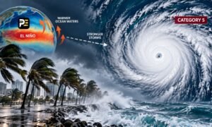
Hurricane Polo Category 5 has rapidly intensified off Mexico’s southwestern Pacific coast, drawing attention not only because of its exceptional strength but also because it has developed as a powerful El Nino event strengthens across the tropical Pacific.
The US National Hurricane Center reported maximum sustained winds of 260 kmph early Thursday, with Polo located about 205 km southwest of Zihuatanejo. The storm was moving northwest while remaining offshore.
The speed of Polo’s intensification has been a major feature of the storm. Its winds increased sharply within a short period, allowing the system to reach Category 5 status on the Saffir-Simpson scale.
The Category 5 hurricane is also being monitored for its potential effects along Mexico’s Pacific coast. Although the centre is forecast to remain offshore, powerful rainbands can still bring heavy rainfall and dangerous conditions to coastal areas.
The broader weather pattern adds another layer to the story. The World Meteorological Organization said El Nino is firmly established and expected to strengthen further, with a near-100% likelihood of persisting through February 2027.
El Nino is a natural climate pattern involving unusually warm sea-surface temperatures in the central and eastern tropical Pacific. Its influence can extend far beyond the Pacific, changing rainfall, temperature and atmospheric circulation in different parts of the world.
The organization has warned that such conditions can increase the risks of extreme heat, drought and flooding, although the effects differ by region and season.
That distinction matters when connecting Polo with El Nino. A strong El Niño can influence the background climate conditions in which tropical systems develop, but it does not mean every individual storm is directly caused by the phenomenon.
The Hurricane Polo Category 5 system will remain under close observation as it moves northwest over the Pacific.